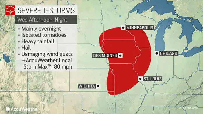
“The main threat to lives and property will stem from showers and thunderstorms capable of producing straight-line wind gusts as opposed to tornadoes from northeastern Oklahoma to southeastern Minnesota, central Wisconsin and northeastern Illinois from late Wednesday to Wednesday night,” AccuWeather Senior Meteorologist Alex Sosnowski said.
AccuWeather forecasters are warning that a wide array of weather hazards will threaten the center of the country as a storm shifts eastward at midweek. The system was slamming the West Coast with excessive precipitation early this week, and it could bring not only rain and snow to some areas of the nation’s midsection but also widespread damaging winds and even the potential for more severe weather.
The storm will come together across the Plains on Wednesday and strengthen throughout the day as it tracks to the northeast. As it makes that trek, it will stir widespread strong to damaging wind gusts along its path, which will cover an area of over 1,200 miles across the central United States.
“Wind gusts of around 50 mph could impact cities such as Milwaukee and Chicago at midweek, which may cause some sporadic power outages as well as cause some minor tree damage,” AccuWeather Senior Meteorologist Dan Pydynowski cautioned.
Winds will be even stronger farther west from New Mexico to Nebraska where gusts of 60-70 mph are likely. Any high-profile vehicles traveling along portions of interstates 70 and 80 may need to take extra precautions on Wednesday as the risk for roll-overs will increase as winds strengthen.


