CARTHAGE, Mo. – A tornado watch has been issued for Jasper County, including Carthage, through 3 a.m. Tuesday as a line of potentially severe thunderstorms moves toward southwest Missouri.
The National Weather Service Storm Prediction Center issued Tornado Watch 703 at 7:35 p.m. Monday, Nov. 2. Jasper County is among four Missouri counties included in the watch.
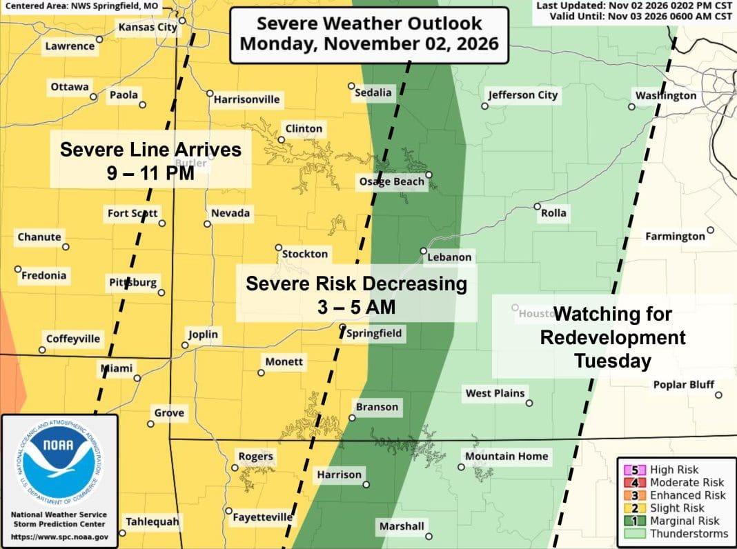
The latest forecast from the National Weather Service in Springfield places Jasper County in a Slight Risk (2 of 5) for severe thunderstorms late Monday night and overnight.

Brief tornadoes and damaging wind gusts are the primary concerns. Wind gusts could reach 60 mph.
The main line of storms is expected to reach the Kansas-Missouri border between 10 p.m. and midnight, then move east toward the Highway 65 corridor between 2 and 5 a.m. Tuesday.
Forecasters say the tornado threat is associated with storms that could produce brief, rapidly developing tornadoes. Although a stronger tornado is possible, weaker tornadoes are considered more likely.
Residents should have multiple ways to receive weather warnings overnight, including a cellphone with Wireless Emergency Alerts enabled or a NOAA Weather Radio. Those at home should identify a safe shelter location away from windows and be prepared to take cover if a warning is issued.